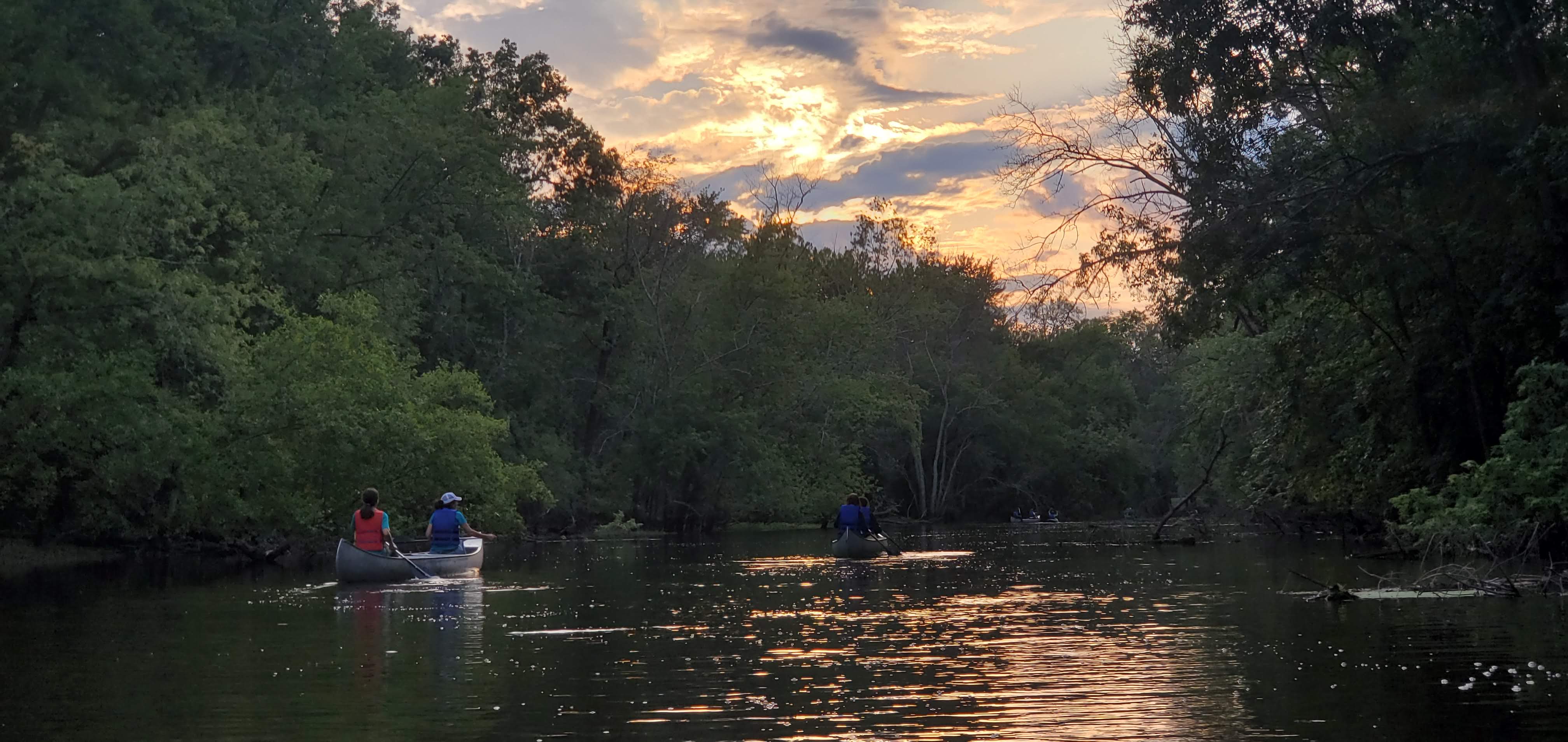
The Upper Passaic River offers wonderful opportunities for recreation within easy access of millions of New Jersey residents. Below I’ve gathered data that highlights potential access points for those interested in exploring. Of course one must paddle at their own risk and do their own research but hopefully with your input I can continue to add information to this map that fosters confidence in the use of the river for paddlers.
Please comment with helpful edits/updates and send photographs of launch sites to davidethanalexander@gmail.com
Passaic River Facts
- Passaic or “pahsayèk” is a Native Lenape American word meaning “valley”.
- Native Lenape indians lived along the river before European settlement.
- The first colonial settlement along the Passaic was in 1666 at present day Newark.
- The Passaic River is about 80 miles long and flows through forty-five municipalities and seven New Jersey counties .
- Everyone lives in a watershed or land that drains into a body of water. The Passaic River is one of 20 state-wide watershed management areas within New Jersey.
- By using and sharing your appreciation of the river we can work together to protect the health, safety and ecological integrity of the resource.
If you would like to join or schedule an Upper Passaic River Paddle trip check out the following resources:
- Essex County Environmental Center
- Somerset County Parks
- Hackensack River Canoe & Kayak Club
- Kayak East Tours
Fish Species found in the Upper Passaic
Largemouth Bass           Micropterus salmoides
Smallmouth Bass          Micropterus dolomieu
Yellow Perch                 Perca flavescens
White Perch                  Morone americanus
Bluegill                     Lepomis macrochirus
Pumpkinseed                Lepomis gibbosus
Rock Bass                    Ambloplites rupestris
Yellow Bullhead             Ameiurus natalis
Chain Pickerel               Esox niger
Northern Pike                Esox lucius
White Sucker                Catostomus commersoni
Spotfin Shiner                Cyprinella spiloptera
Spottail Shiner               Notropis hudsonius
Redbreast Sunfish          Lepomis auritus
Golden Shiner                Notemigonus crysoleucas
Fish Advisories per New Jersey Department of Environmental Protection
For information on the Lower Passaic River Access Points click Here (big pdf).
and to plan for bigger paddles it may help to monitor water levels
David Alexander is a professional outdoor guide and conservation biologist. He enjoys making nature more accessible to people and wildlife. You can follow him at www.natureintoaction.com

[…] have included Buzz Into Action, Hop Into Action, Recycling Education, Wild About Wildlife and Using Digital Mapping to Improve Nature […]
[…] To learn more about the fish species click here […]
I am looking forward to exploring the Passiac with my wife – as a birthday gift to myself. We’ll use the Essex County put-in at the Environmental Center on Eagle Rock Ave. I hope good weather holds out (heavy rain is forecast, which would cancel the trip). I won’t return to comment (I am a hit and miss commenter), but do know that people out there are hearing of these things. Thanks for the article.
enjoy!
Hey David, thanks for this article and map, very useful. I am looking forward to doing this trail with my wife and kids.
Do you think is doable in one day, from Lord Stirling Park to Suchorsky Park, in two double inflatable kayaks? 🙂
Hi Mimold,
No, I don’t think so. That is a BIG trip especially in inflatable kayaks, with kids, low current water levels and unknown obstacles like fallen trees. I would take some small bites and slow down and enjoy the scenery, birding, wildlife, fishing, etc…
Best of luck,
David
[…] benches, cold frames, recycled plumber garden benches, Adirondack chairs, trail-head kiosks, canoe & kayak river access trails, animal tracking stations, camp skills knot tying board, bird feeding area display, small bridges, […]