These trail descriptions are provided by volunteers of the Mount Olive Open Space Committee to highlight our trail system and our outdoor treasures within our 31sq mile township. The descriptions are best used with our trails map.
You can find the interactive map of our trail system here:
Thank you for leaving the trails better than you found them. To assist with trail improvements or report on trail conditions please contact the Mount Olive Open Space Committee (mtotrails@gmail.com) and join our Facebook group to learn more about trail walks and volunteer opportunities. You can also sign on to become a trail steward HERE and stewards may share a trail report HERE
Mount Olive Trail Regulations
- Trails are open from dawn to dusk.
- Trails are carry-in, carry-out; refuse is to be disposed of properly.
- Pets must be kept on leash and cleaned-up after.
- Motorized vehicles are prohibited, including ATVs, motorcycles, and snowmobiles. Police may impound such vehicles pending a municipal court hearing.
- Horses and bicycles are allowed on some trails (check trail descriptions).
- Please use our trails with a stewardship ethic, leave them better than you found them.
- Respect private property and nearby homes. Stay on designated trails.
Recommendations
- Wear bright colors on all trails during hunting season (September through February).
- Tell someone where you are going and when you expect to return.
- Prepare for weather changes and bring plenty of water.
- Make sure to check yourself for ticks upon the completion of your hike.
- Bring a bag to collect any litter
- Share photos on social media to help highlight our natural areas and recreational opportunities.
TRAIL DESCRIPTIONS
WHITE TRAIL (View/Print PDF of the White Trail Map)
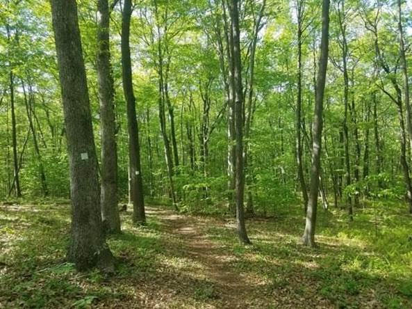
Description: This trail begins on Old Budd Lake Rd ( 40.887964, -74.723251 ) behind Adams Bagels. It enters a hardwood forest and ascends before crossing under the power line right of way and meandering through a wooded wetland habitat. The trail curves around a large dead forest that has been flooded by beavers. The dead trees have become a rookery for herons to raise their young. You’ll walk over some boardwalks built by township eagle scouts and come to the Gold Mine Road parking area in .08 miles
( 40.878577, -74.720833 ).
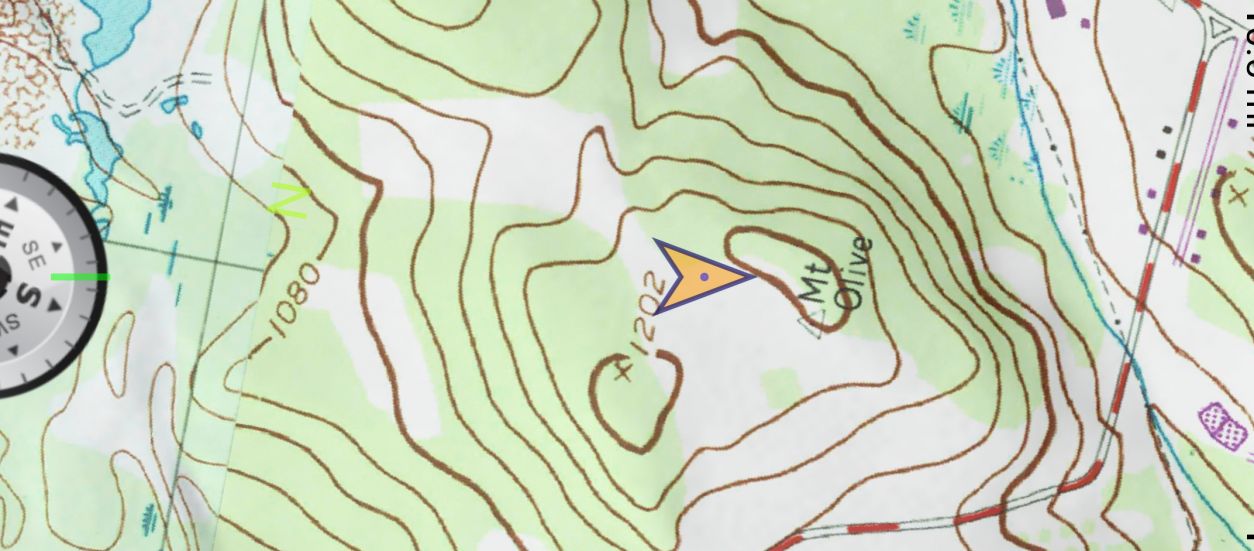
Due to beaver activity, boots are strongly recommended. The trail then reenters the forest and gently gains elevation as it winds through the Turkey Brook Park Greenway reaching its highest elevation of 1202 feet at Mt. Olive just before the large Greenway parking area on Flanders Rd in 1.1miles (40.865919, -74.717325).
After a short walk along Flanders Rd. the trail enters into the east side of Turkey Brook Park (40.867060, -74.725483) on a gravel driveway. The white trail now continues 1.6miles downhill through a forested trail toward the pond. After reaching the pond, the white trail loops around the southwest side of the pond, crosses Turkey Brook (a NJ Fish and Wildlife designated wild trout stream) over a log bridge, and ascends east to slightly higher elevation through a forested trail onward to School House Lane and further along to the High School 0.6miles (Lot D when school is not in session) creating the potential to loop back towards the Greenway Parking Area in 0.8miles (40.865919, -74.717325) and/or a return hike to where the trail begins off of route 46 1.9 miles away (40.887964, -74.723251).
Trail Distances:
Adam’s Bagels to Goldmine Road 0.8miles
Goldmine Road to Mt. Olive Greenway 1.1miles
Mt. Olive Greenway to Mt. Olive High School 0.8miles
Mt. Olive High School (Lot D when school is not in session) to Maiers Pond 1.6miles (new added reroute toward entrance of high school and down School House Lane – DO NOT CUT THROUGH BEHIND THE BASEBALL DIAMOND AS THAT IS PRIVATE PROPERTY – (2025 Reroute scheduled)
Maiers Pond through Turkey Brook Park to Greenway 1.6miles
MAIERS POND

Parking: Drive or walk down the gravel road behind the Dog Park in Turkey Brook Park
Distance: 0.4 mile to the pond from the gate.
Description: From the gate located at the back of Turkey Brook Park walk down hill on the gravel pathway to the pond. On the way you will pass stands of Staghorn Sumac and Autumn Olive, pass a small open field known as the bird sanctuary and continue down through a hardwood forest of Oak and Maple to reach the pond. You may wish to turn around after enjoying the pond or continue further on an extended hike using the trails map. The white trail continues past the pond towards Mount Olive High School and does offer a loop around if you connect with the orange trail (approximately 1 hour). Look for Beaver, Kingfisher, Pileated Woodpecker and more. The pond offers wonderful opportunities to fish for Bass, Bluegill and Perch. Please be sure to carry out fishing refuse and leave the place better than you found it.
MORRIS CANAL GREENWAY (PREVIOUSLY THE BRAILLE TRAIL)
Parking: Continental Drive, Budd Lake ( 40.908418, -74.720006 ) or Plane Street in Stanhope, NJ ( 40.904082 -74.712377 )
Distance: 1.4 miles there and back.
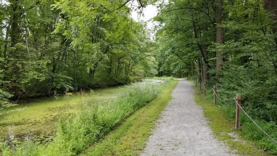
Description: This trail located in Allamuchy State Park is 0.7 mile one way and meanders along a section of the old Morris Canal. The trail is a smooth gravel pathway and passes the stone ruins of the lock tenders house 0.2 mile from Continental Drive. Look for the many Painted Turtles basking on rocks and logs and King Fishers feeding when water levels are low. Native plant species including Goldenrod, Joe Pye Weed, IronWeed, Milkweed and Elderberry are on brilliant display during the late summer and early autumn (service projects available to remove encroaching invasive plants). This trail also offers excellent opportunities for a level snowshoe or xc ski pathway. At the entrance of Plane Street on the Stanhope side of the trail is an old bridge that crosses over the Musconetcong River.
SILVER SPRINGS TRAIL (red trail w/ pink and blue loops)

")
")
BUDD LAKE VISTA KNOLL TRAIL
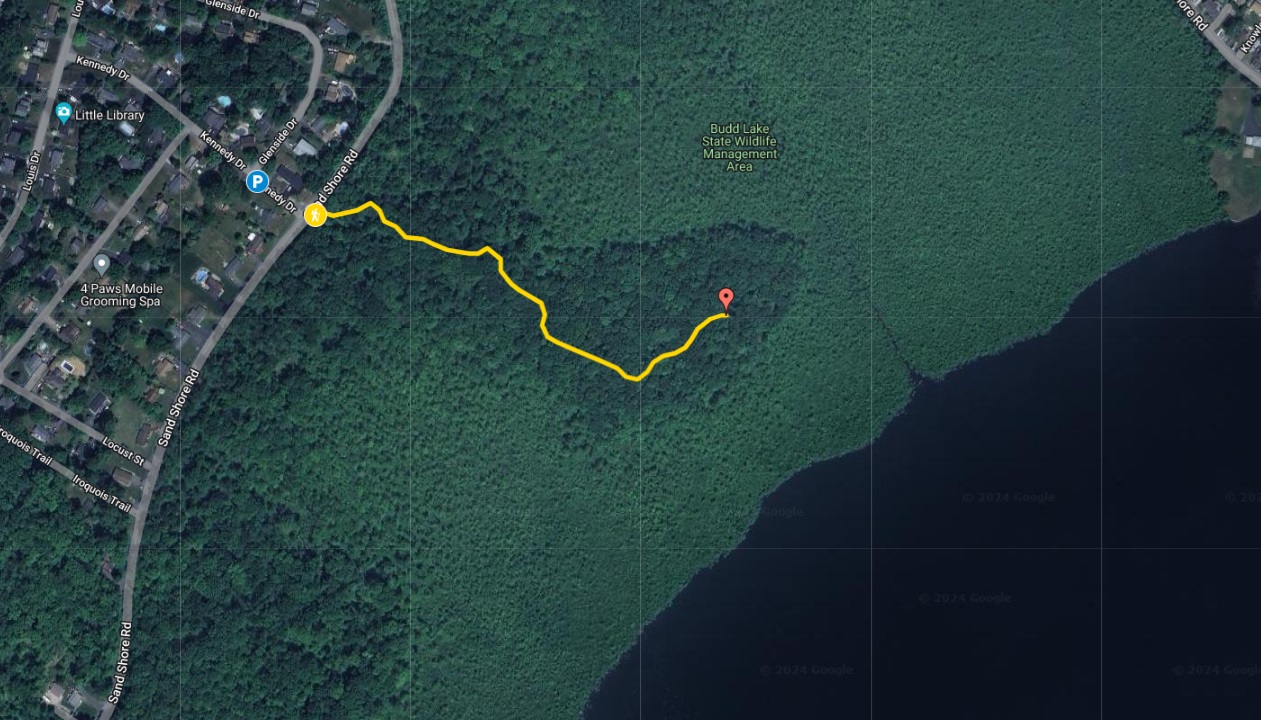
Parking: Along Kennedy Drive. Distance: 0.4 miles
Description: Enter the yellow blazed trail into the forest opening along Sandshore Road and walk down into a wooded wetland area before ascending to the vista overlooking Budd Lake. The view will be best when the leaves are down off the trees. It takes approximately 45mintues to hike out and back.
- Did you know the lake has a maximum depth of 12 feet and is on average about 9 feet deep!
- The lake is the headwaters of the South Branch of the Raritan River!
- The Budd Lake Bog was created by thousands of years of decaying plant material and supports wetland species including black spruce and tamarack which grow on the floating mass!
- The lake is recharged through groundwater seepage through a series of wetlands!
Thank you for leaving the trails better than you found them. To assist with trail improvements or report on trail conditions please contact the Mount Olive Open Space Committee (mtotrails@gmail.com) and join our Facebook group to learn more about trail walks and volunteer opportunities. You can also sign on to become a trail steward HERE and stewards may share a trail report HERE

Are any trails wheel chair accessible?
The MORRIS CANAL GREENWAY (PREVIOUSLY THE BRAILLE TRAIL) is most accessible of the trails. Start at the Plane Street trailhead in Netcong.
Parking: Continental Drive, Budd Lake
(40.908418, -74.720006) or Plane Street in Stanhope, NJ ( 40.904082 -74.712377)
Distance: 1.4 miles there and back.
Description: This trail located in Allamuchy State Park is 0.7 mile one way and meanders along a section of the old Morris Canal. The trail is a smooth gravel pathway and passes the stone ruins of the lock tenders house 0.2 mile from Continental Drive. Look for the many Painted Turtles basking on rocks and logs and King Fishers feeding when water levels are low. Native plant species including Goldenrod, Joe Pye Weed, IronWeed, Milkweed and Elderberry are on brilliant display during the late summer and early autumn (service projects available to remove encroaching invasive plants). This trail also offers excellent opportunities for a level snowshoe or xc ski pathway. At the entrance of Plane Street on the Stanhope side of the trail is an old bridge that crosses over the Musconetcong River.
Thank you!
Turkey Brook has paved trails around the recreation are. Flanders Park also has paved walkways. None of the woodland trails are paved to my knowledge. I use a wheelchair myself.
[…] look forward to her achieving the rank of Eagle Scout in the near future.” Check out our Map at https://natureintoaction.com/2021/03/10/mount-olive-trails-interactive-map/ To inquire about scout and conservation stewardship themed service projects within Mount Olive Open […]